Super Typhoon Bavi weakens but still threatens Taiwan and southern Japan
Super Typhoon Bavi is showing signs of weakening but remains a powerful system as it moves toward Taiwan and southern Japan.
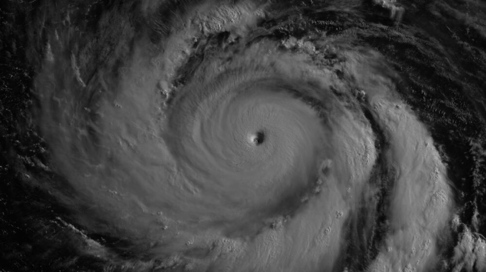
By July 8, Super Typhoon Bavi remained a formidable typhoon despite showing signs of gradual weakening, according to satellite imagery released by NASA showing the storm moving west across the Philippine Sea, southeast of Taiwan, with maximum sustained winds still estimated at around 250 kilometres per hour.
Forecasts suggested the cyclone could begin curving northwest, potentially affecting Taiwan, the Ryukyu Islands of southern Japan and parts of mainland China. Although further weakening was expected over the following days, Bavi remained a powerful system capable of producing damaging weather far from the islands where it first made headlines.
The storm had reached super typhoon status on July 4 local time, with sustained winds climbing to around 290 kilometres per hour as it crossed near Guam and the Northern Mariana Islands — becoming the third Category 5 tropical cyclone of 2026. A NASA-supported satellite captured the storm near peak intensity shortly after midnight local time on July 6, showing a tightly organised eyewall partly illuminated by moonlight.
As forecasters continued to track its path, Bavi stood out as one of the strongest tropical cyclones observed anywhere in the world during 2026, intensifying over sea surface temperatures of around 30 degrees Celsius that provided ample fuel for the storm.



Leave a Reply